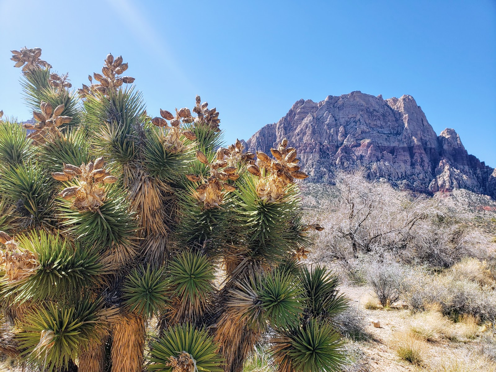
Among the Spring Mountains, there are miles of hiking trails waiting to be explored. Nowadays if you drive along Blue Diamond Road / Red Rock Canyon Road you will find many bike riders, some joggers, and many vehicles parked alongside the road. More people than ever are taking advantage of the nice hiking back into the Spring Mountain canyons. And with the recent rains, there is more water flowing than ever.
If you're a nature lover then one of the many hiking trails in the Spring Mountains is for you. On hot days the going is a little tough when you first start out, but the cool breezes gently fall from the peaks as you make your way deeper into the canyons.
South Oak Creek isn't a spectacular hike and it can be a little rigorous when you first start out because of the rocky trail. After you've made your way closer to the mountain base you'll find things a little easier. For this writing I'm letting you know I did not stay on the trail all the way into the canyon. Just before the split in the trail at the base of the mountain I diverged slightly left and went off-trail. Sometimes off-trail is more serene with a tad more peace.
Because I went off-trail on the way in, the pictures following will look unfamiliar if you're a regular. You too can go off-trail because once you're at a place where it's either too difficult or you're just ready to get back on-trail you head north (right when facing the mountains) and you'll eventually hit the trail once again.
Pack a small lunch and some water and plan on making this a multi-hour hike. Relax and take your time. There's usually water flowing so you'll want to explore on your way up.
As you can see in these pictures the trail appears to shoot straight back to the canyon. Although it looks easy, the trail is fraught with large rocks most of the way so you'll want to pay attention. It's not a difficult walk, but it can be dangerous when you're looking around at the scenery instead of your next step.
Although they're not visible from the road there are pine trees growing at the base. You wouldn't think so because they are seldomly seen growing in the desert without at least some kind of artificial water source. Off-trail there are a number of very old, dead, fallen trees.
Surprisingly enough, I did run into three people separately on this hike while off-trail. Like-minds, I guess when solitude is in the outlook. The following two shots are panoramas looking back towards the road. It's a couple miles off in the distance so not exactly visible.
For you younger folk you may not recognize the next picture, or maybe you will. I think manufacturers stopped making these cans back in the late 70's or early 80's. They used to have a pull tab which people used to take off and toss. Personally I used to pull it and drop it into the can. Obviously this can has been out here for decades.
Finally when you reach the wash it's a rather welcome site to find water traversing through the rocks and meandering its way until it inevitably disappears beneath the sand. If you have the time follow the water, or trails, far back into the canyon as you can.
This will be the last update about Lake Harriet at Spring Mountain Ranch as the lake is now nearly full. Here are the latest shots from the lake on Feb 29th, 2020. Time to start enjoying the lake once again. Note, the full walk around the lake is still not open and the fence is still in place keeping you about 20 ft from the water's edge.
For those of you who are excited
the lake is on its way back, here is an update on the water level. It's
moving up quickly, my best guess is around four feet per week. The
following pics are good indicators of where the water level is at from
only a couple weeks ago.
By
the end of February 2020 I would presume, at the current volume of
fill, the lake should be full. While I'm sure some people will one again
introduce invasive species into the waters we can at least enjoy the
view.
If you see
someone dumping something into the water or doing what they shouldn't be
please use your cell phone to take a picture or video and bring it to a
ranger.
On another side note, thankfully, rangers are diligently patrolling the trails, thank you rangers!
Have you ever heard of or visited Grapevine Canyon? This is a must-do hike. The area is deserted most of the time. I have hiked here twice and have never seen a soul.
The following graphic is an inverted trail map from the last visit I made. You can see the trail itself is reasonably straight but I like to take many detours to really see the sites.
Driving to the canyon is not difficult. From Las Vegas, you need to take US 95 South towards Needles, Laughlin, or Bullhead. From the intersection of US95 and US93 head south for approximately 55 miles. Turn left, east, NV163 for 12.8 miles and turn left, north, onto the dirt road. At the entrance of the dirt road, you will see the sign in the following graphic. I placed GPS coordinates onto the pictures so you are able to both navigate to the location and throughout.
The hike is not strenuous but don't do this during the heat in the middle of the summer unless you arrive very early or about two hours before dark. The next graphic shows the elevation gains from my hike.
Here are a few GPS waypoints for your convenience. Don't just trust these because I've posted them, use your own device to also mark your parking spot, just in case. You never know, my device may have been way off, so use them at your own risk.
At the trailhead and parking lot there are very nice restrooms. Use them before you start hiking. Why go on the trail when you have such a convenient item.
Also at the trailhead is a sign letting you know more information about the area.
The beginning of the trailhead is clearly marked.
The really great aspect of this hike is all the petroglyphs, they're all over the rocks.
As you hike further into the canyon you will come across some interesting rock areas. One of these areas is as smooth as glass and was obviously formed by millions of years of water flow. Note in the next picture you can see the smooth rock on the left, but also look to the top of the picture in the center. There's a huge multi-ton boulder caught between two cliff faces.
These next pictures give you a better view of the boulder.
In the picture above, #19, you can see on the lower-left, the green plants growing, these are what gives the canyon its namesake. They're wild grapevines.
At the time I took this hike it was in the middle of summer and about two hours before dark. It was hot but not unbearable. I mention this because there was still water in some of the crevices of the smooth rocks.
Next are a patch of several dead trees. They are the only ones left laying around these parts. They may very well be the last of any trees which grew in this hot desert.
You can go further than this last photo shows, but my meandering took quite some time to get here so this is the point, this time, where I turned around. As long as you stay in the wash you really can't become lost.
The next time you visit Vegas, if you have the opportunity, don't pass this quick trip by.
It's been a while, and I visit the Spring Mountain Ranch in Las Vegas rather often. Finally, after several years they've decided to start filling Lake Harriet again.
One of the major attractions of the park is the lake. There used to be benches around the perimeter and on many days the lake was a great place to unwind. After watching what was done for several years now it appears the only things done were to remove the reeds around the perimeter and around the island. Additionally, they laid boulders around the inside east and south edges, as can be seen in the picture above.
There were two reasons provided for the lake draining: 1) the Pupfish were in danger of extinction and 2) the dam was not sound. Whether these stories are true or not no longer matters. It's good to see the lake return.
Since I make a trip almost every week, the lake is filling rather rapidly. I did skip one week venturing to the park and there was very little water in the lake on my previous trip. So as you can see the water is rising very rapidly.
If you have not been to the park in a while I suggest you come back to venture a hike near the lake. The next question now is whether or not they open the walkway around the perimeter and remove the makeshift fencing. If they're worried about people placing invasive species into the lake they can either continue to worry or go with it because there are many people out there who disrespect everything the majority of us cherish.
Here's what the lake looked like before they drained it.